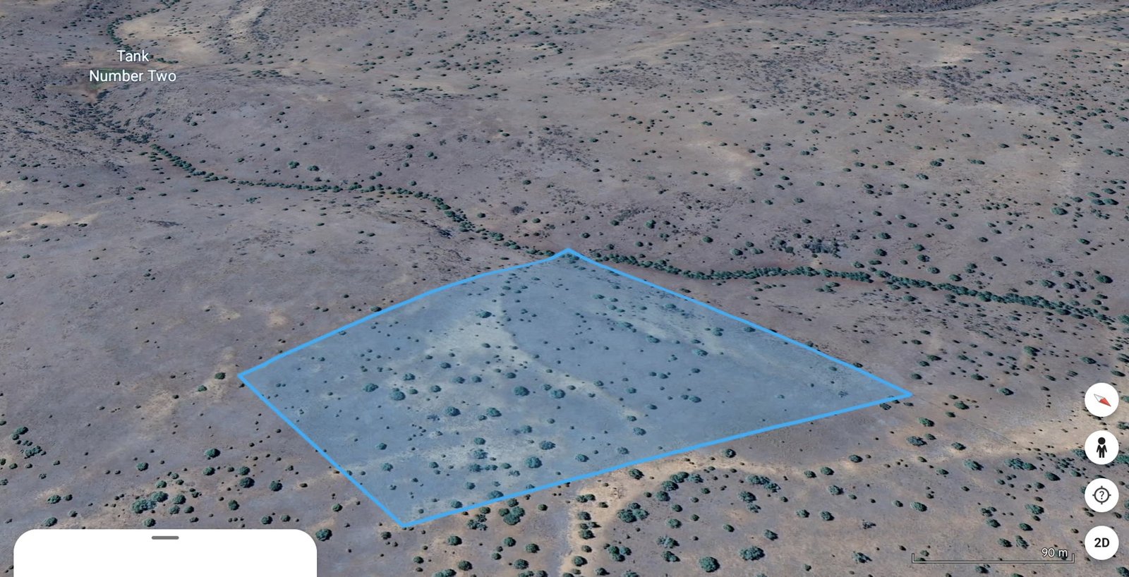
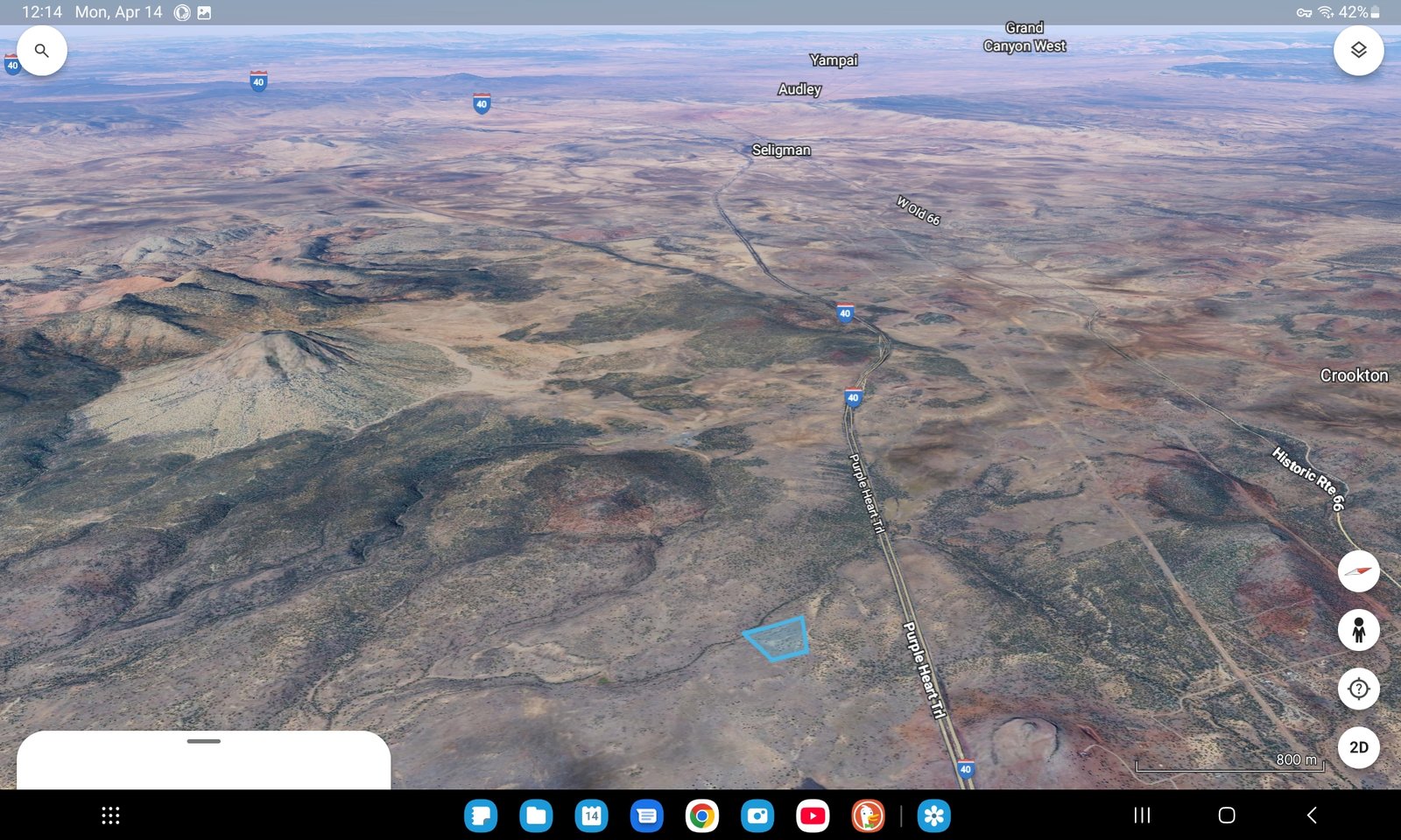
Juniper Woods Ranch

Juniper Woods Ranch Ash Fork Arizona 16 acres hillcrest canyon overview

16 Acre Lot Ash Fork Arizona • Yavapai County • Canyon Creek & Pond

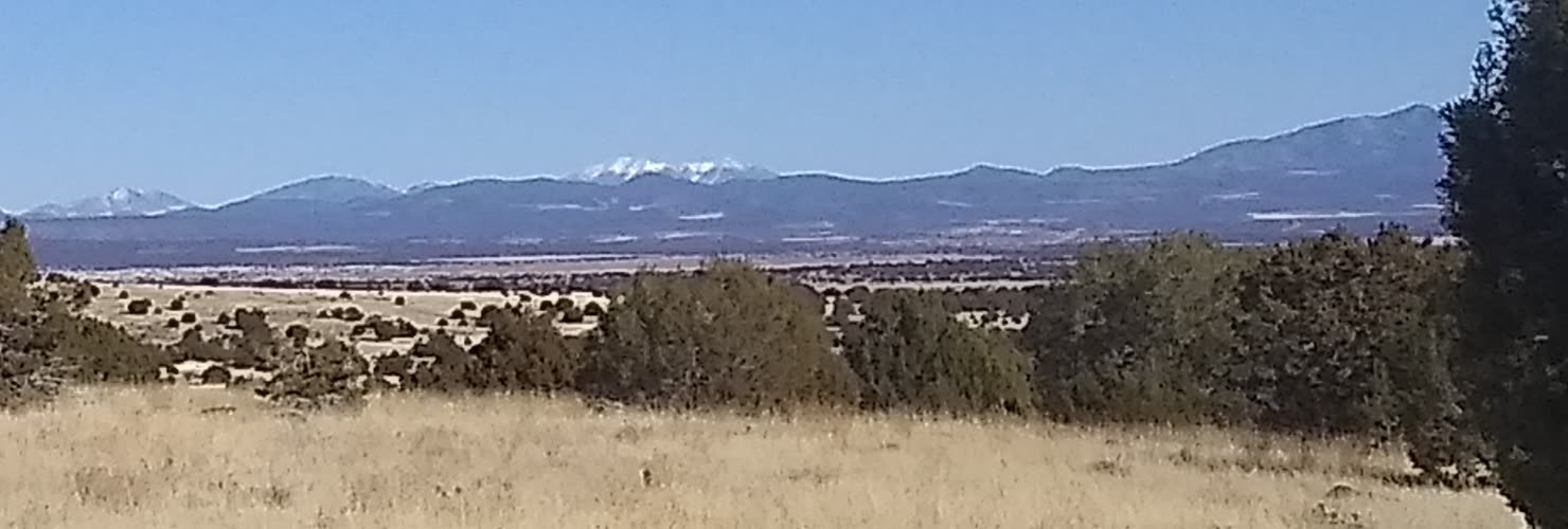
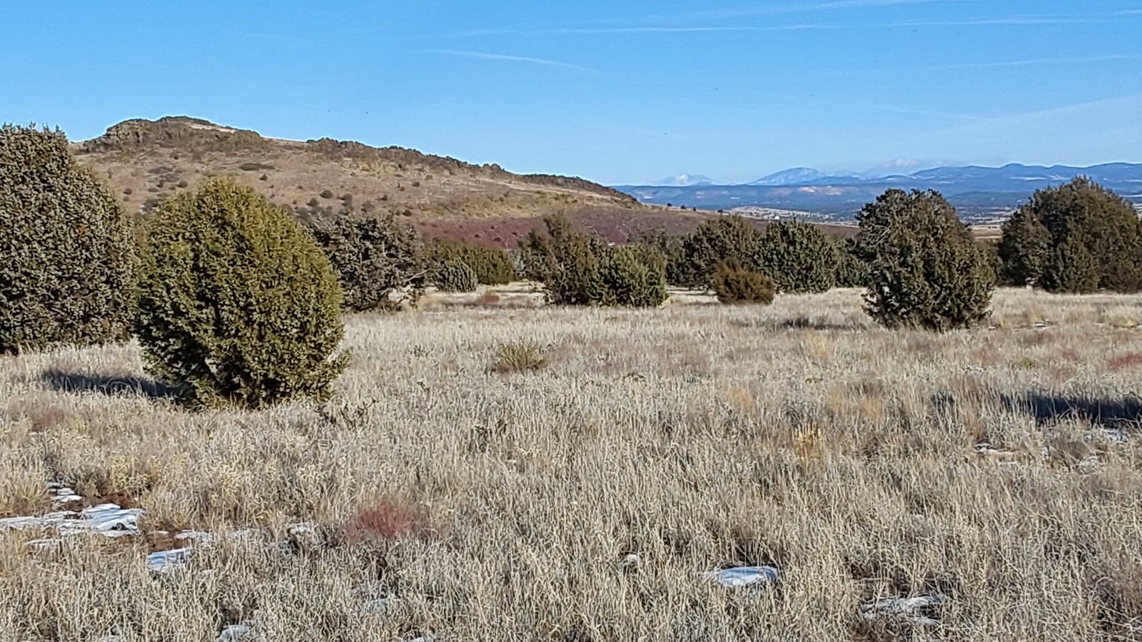
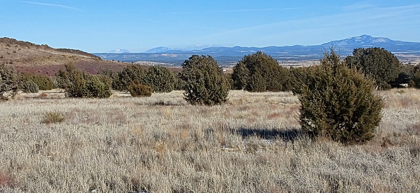
Discover Juniper Woods Ranch - a truly remarkable 16-acre property in Ash Fork, Yavapai County, Arizona, offering breathtaking panoramic 360-degree views. This hillcrest raw land sits majestically above a serene canyon creek and pond, surrounded by mature juniper trees that create a natural forest sanctuary. With unobstructed vistas stretching over 100 miles to the east, this elevated desert property provides an awe-inspiring outdoor experience along the historic Route 66 corridor.
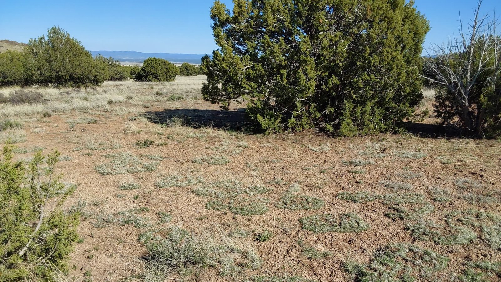
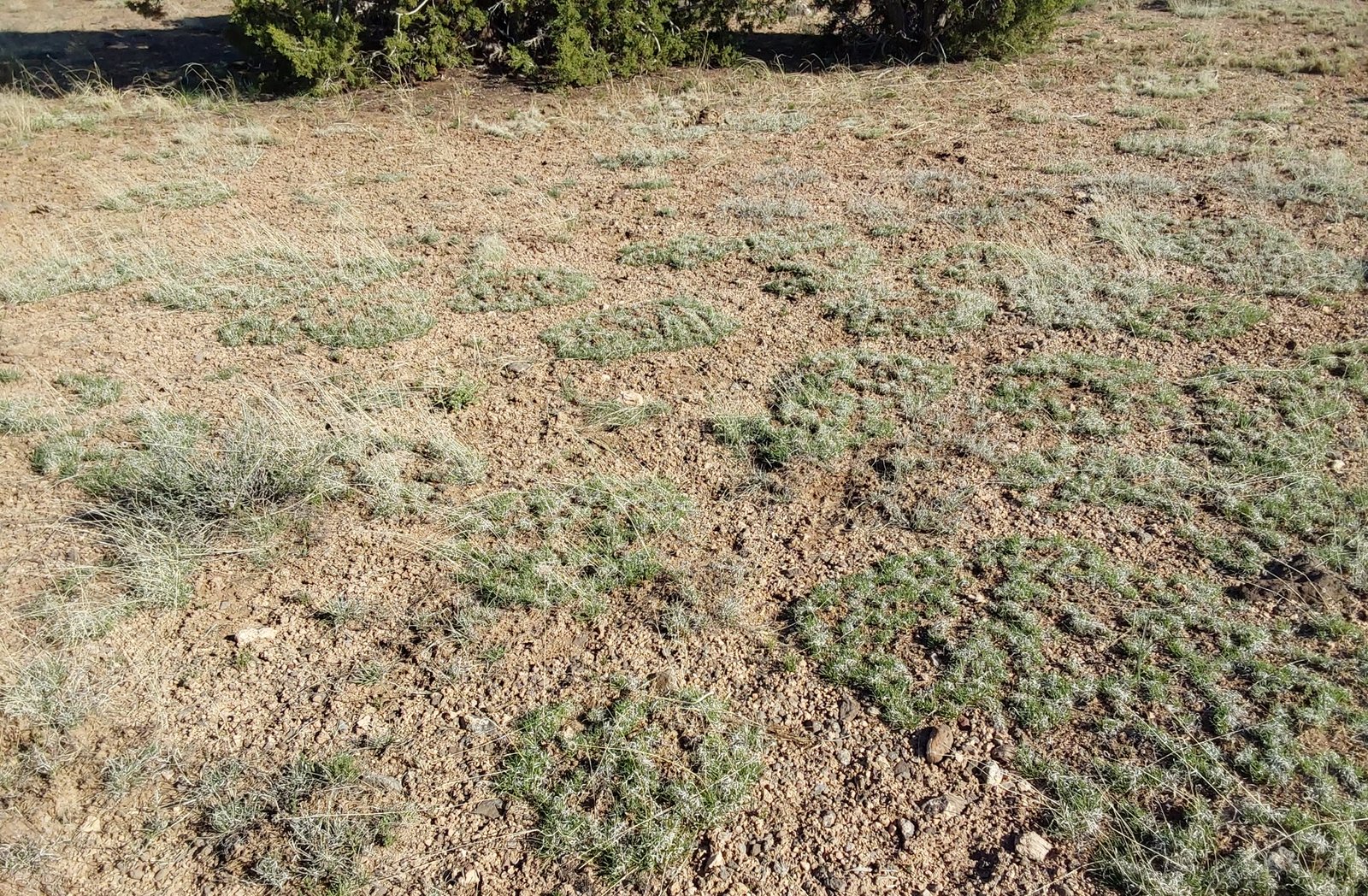
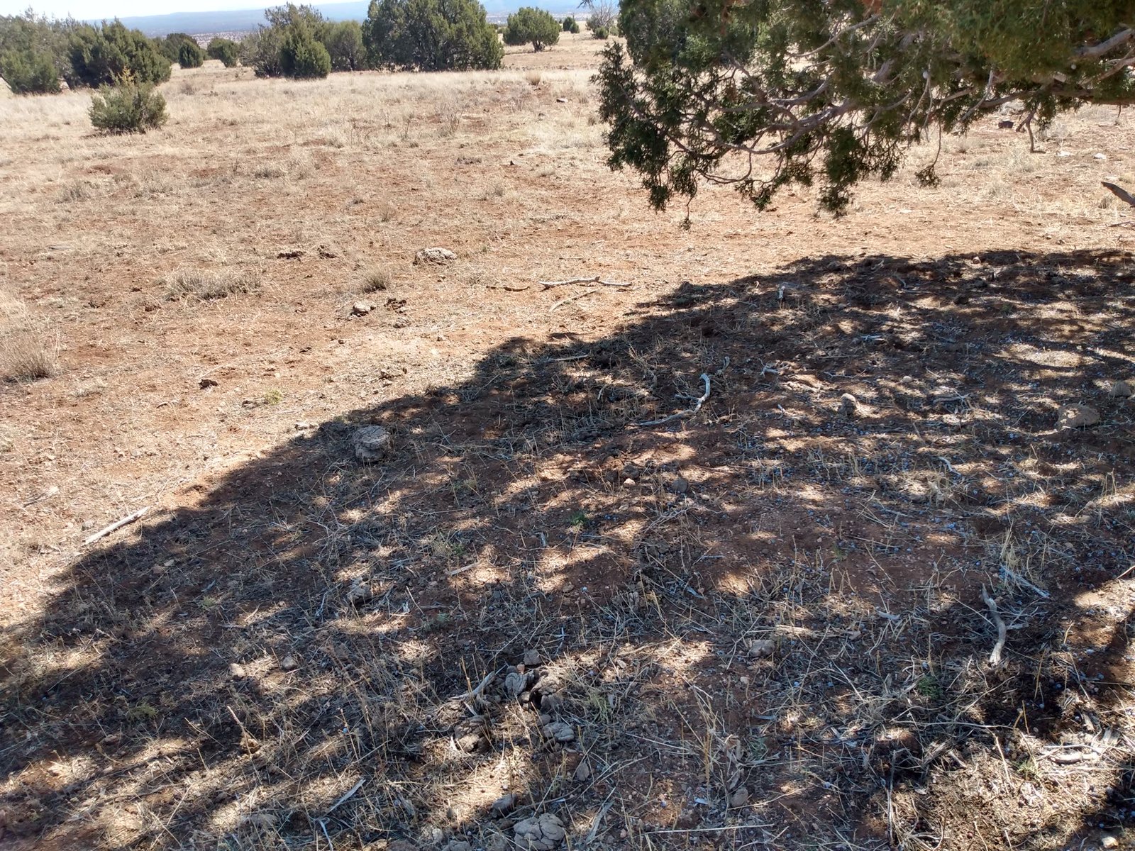
Wake up to stunning sunrises behind the snow-capped San Francisco Peaks and Bill Williams Mountains, with different colored skies greeting you every morning. This Ash Fork Arizona raw land spans 16 acres of natural high desert landscape with excellent topsoil, offering ample space for your vision to unfold on this juniper-covered hillcrest property.
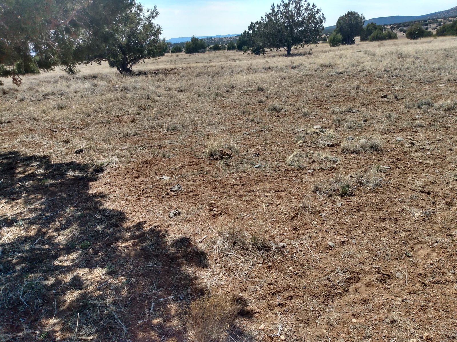
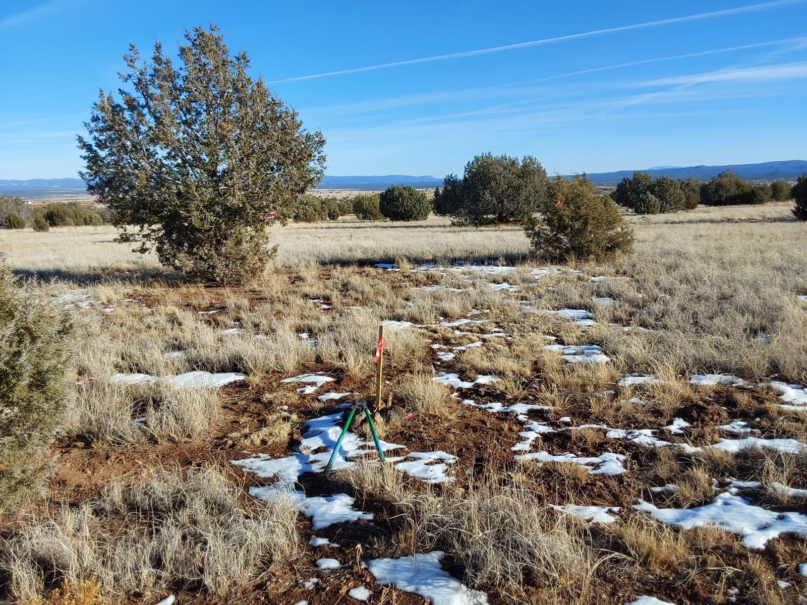
Perfect for your family retreat or custom home site, this Yavapai County property features 4-5 large open clearings with flat buildable areas and rich topsoil. The land offers complete flexibility for development with no HOA restrictions - giving you the freedom to create your dream oasis in Arizona's beautiful juniper woodland setting.
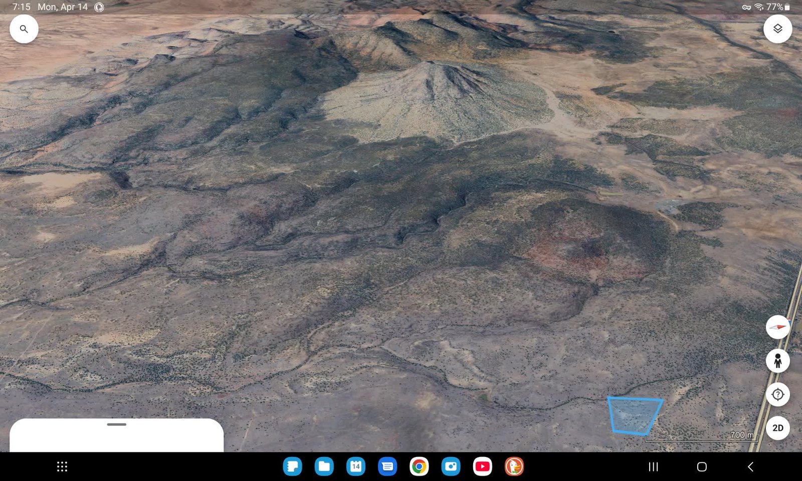
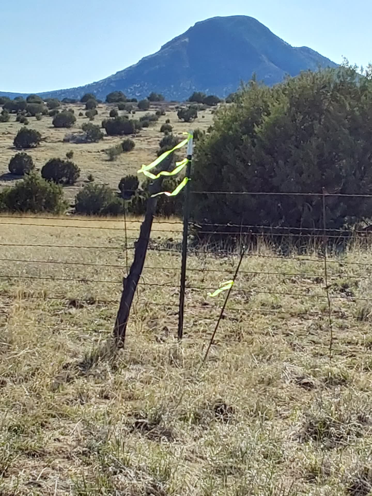
The western boundary of Juniper Woods Ranch is enhanced by majestic volcanic terrain with creeks and miles of mountain preserve hiking trails. Watch spectacular sunsets behind the volcano mountain preserve with its snow-capped peaks, and witness hundreds of waterfalls cascading around the volcanic landscape after desert rainstorms - a truly magical sight unique to this Ash Fork Arizona location.
Ash Fork Arizona volcano waterfalls mountain preserve Juniper Woods Ranch
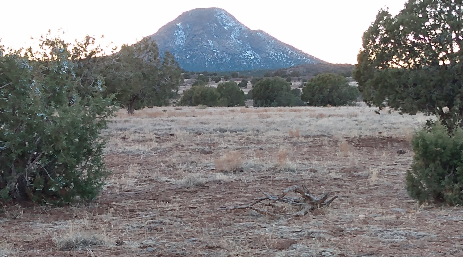
Volcano Mountain Preserve Waterfalls
Yavapai County Arizona raw land juniper trees canyon creek property view

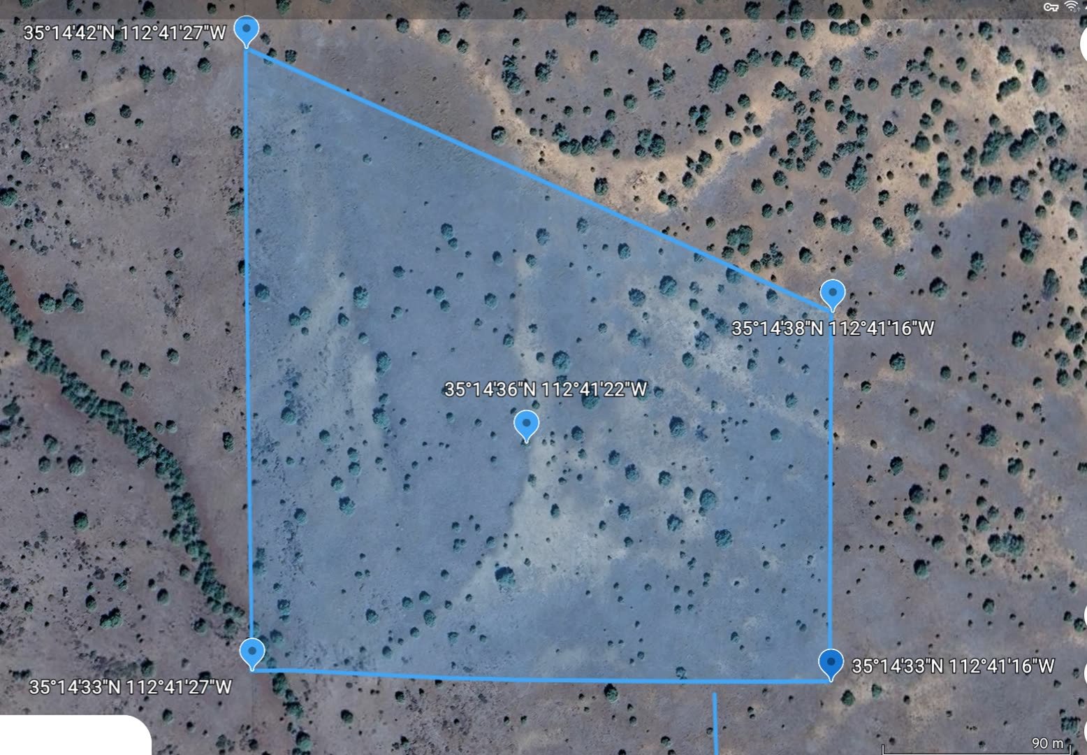
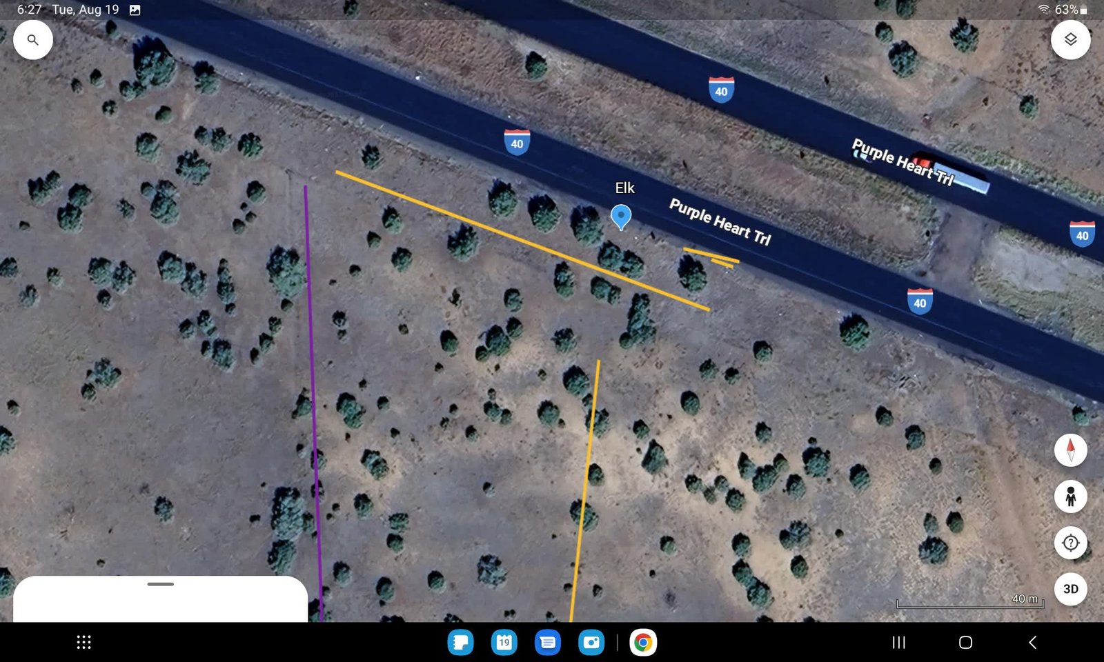
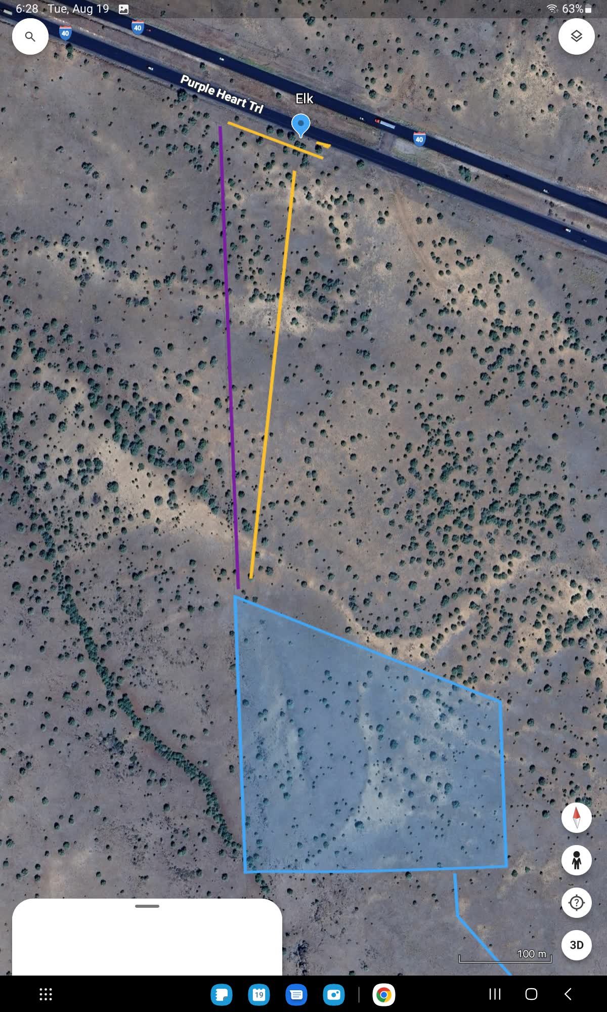
GPS Property Coordinates

NW Corner: 35°14'42"N 112°41'27"W

NE Corner: 35°14'38"N 112°41'16"W

SW Corner: 35°14'33"N 112°41'27"W

SE Corner: 35°14'33"N 112°41'16"W

General Center: 35°14'36"N 112°41'22"W

16 Acre Parcel Details:

Location: Ash Fork, Yavapai County, Arizona
Features: Canyon creek, pond, mature juniper forest
No HOA restrictions - RCU-10A Minimum Local Zoning
Lot Size: 16 Acres hillcrest position
Seller Financing Available
Good Cash Down and Flexible Payments
No Credit Check Needed
Group of Friends Names OK
Part Trade Accepted for Good Running Car/SUV/Truck
16 Acres ... We'll Take Best Offer!
Call Any Day Or Time ... 480-353-8476

RawLandTrade@GMaiL.Com
Ash Fork Arizona Juniper Woods Ranch aerial survey GPS coordinates
Aerial survey view showing the complete 16-acre Juniper Woods Ranch property with GPS coordinates and boundary markers clearly visible.
Yavapai County Arizona 16 acres raw land juniper trees hillcrest
Eastern hillcrest view showcasing the mature juniper forest and natural terrain of this Yavapai County raw land property.
Ash Fork Arizona volcanic terrain canyon creek Juniper Woods Ranch
Majestic volcanic terrain along the western boundary featuring dramatic canyon formations and seasonal creek systems.
Arizona high desert juniper forest raw land panoramic views
Rich topsoil quality throughout the property, ideal for landscaping and development with excellent drainage characteristics.
Yavapai County Arizona raw land pond creek juniper trees
Prime building site location with flat terrain, established juniper shade trees, and proximity to the canyon creek and pond.
Ash Fork Arizona hillcrest property mountain preserve views
Breathtaking eastern panoramic views toward Flagstaff's snow-capped San Francisco Peaks and Bill Williams Mountains.
Juniper Woods Ranch Arizona flat building sites topsoil
Northeast corner showing one of several flat building sites with excellent topsoil and natural juniper tree boundaries.
Arizona Route 66 corridor raw land Ash Fork Yavapai County
Mature juniper shade trees providing natural cooling and privacy throughout this historic Route 66 corridor property.
Ash Fork Arizona volcano waterfalls mountain preserve hiking trails
Northwest corner highlighting access to volcano mountain preserve hiking trails and seasonal waterfall viewing areas.
Yavapai County Arizona sunset views volcano mountain preserve
Spectacular sunset views over Crookton Township and the volcanic mountain preserve with its dramatic evening sky colors.
I40 Elk Sign reference point for Juniper Woods Ranch access
Approximately 12 miles east of Seligman and 12 miles west of Ash Fork on the south side of I-40. East of mile marker 133, approximately three quarters of a mile east of mile marker 133 and approximately a quarter mile before you reach mile marker 134, you will see 2 large elk signs on both sides of the road. That's a convenient place to park your car on the east side approximately 25 feet past the elk sign. On the right hand side of the road, pull completely off the highway more than 10 or 15 feet. Once you pass the tree, the apron widens out and then park your car there.

Elk Signs: 35°14'58"N 112°41'23"W

Google Maps Link: Direct Google Maps Location

NW Corner of 16 Acres: 35°14'42"N 112°41'27"W

Important: Please contact me by phone for driving guidelines and additional directions. Do not drive on the land without prior discussion. Call for visit coordination.
I40 Northwest Corner fence line reference for Juniper Woods Ranch
These lines represent the fence line connecting from I-40 north and south fence line. On the west side of fence line is state land, on the east side of fence line is Juniper Woods Ranch. You can follow and keep an eye on the fence line and work your way south approximately a quarter mile. You will be able to see the Northwest Corner T-post in the fence line.
Juniper Woods Ranch Ash Fork Arizona 16 acres seller financing
Overview of historic Ash Fork Arizona community below, showing the elevated hillcrest position of Juniper Woods Ranch.